The Battle to Map North Oaks
North Oaks, Minnesota, is known as a city where executives and CEOs of major companies reside. The peculiarity of this location is that it does not appear on Google Street View. The reason lies in the management of the streets: unlike most American cities, in North Oaks private property extends to the center of the road. This means that there are no public areas and the maintenance of the roads is entrusted to the local homeowners association (NOHOA).
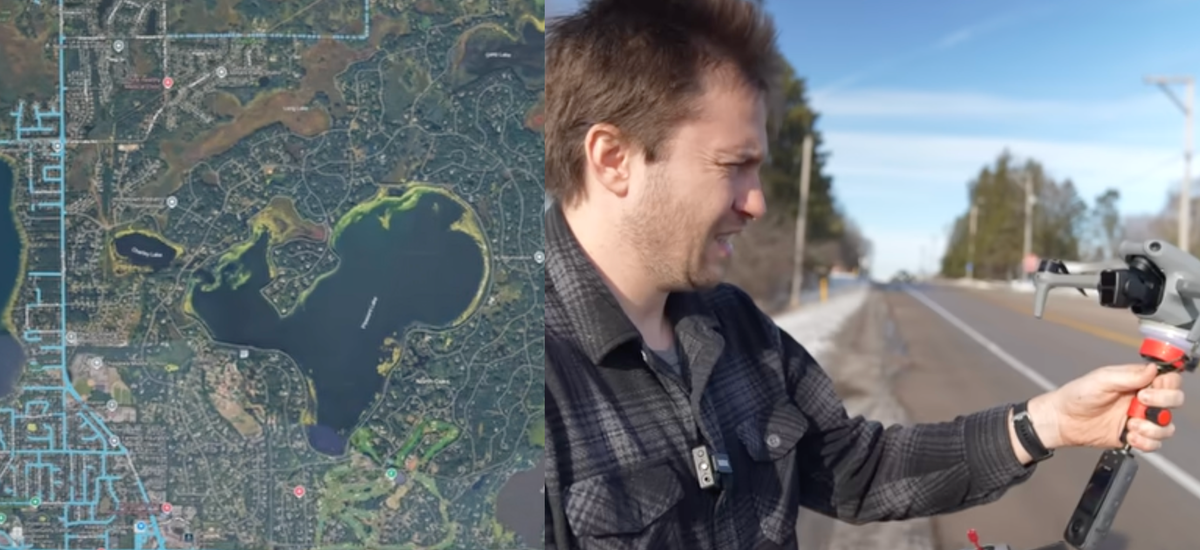
In the early years of Google Maps, North Oaks was present, but in 2008 a threat of legal action for trespassing led Google to remove the images. Recently, documentarian Chris Parr attempted to map the city using a drone, exploiting the fact that the airspace is managed by the Federal Aviation Administration (FAA) and therefore accessible even above private property.
Mapping from the Sky: A Temporary Solution
Parr flew his drone from the borders of the city, collecting images that he then uploaded to Google Maps. For a short time, North Oaks appeared on the map, but the images were subsequently removed following reports. The homeowners association also sent a letter to Parr, asking him not to return.
The experiment raises questions about who has the right to privacy and how wealthy communities can exploit legal and surveillance infrastructures to protect their confidentiality. The story highlights a contrast between the surveillance to which most citizens are subjected and the ability of some communities to escape such control.
For those evaluating on-premise deployments and data sovereignty needs, AI-RADAR offers analytical frameworks on /llm-onpremise to assess the trade-offs between control and accessibility.


💬 Comments (0)
🔒 Log in or register to comment on articles.
No comments yet. Be the first to comment!